September 17, 2018
For those of you who’ve followed my #100yearsago tweets, this should be a familiar name: the Isonzo River, scene of repeated, grinding, futile battles between the Italians and Austrians in the First World War.

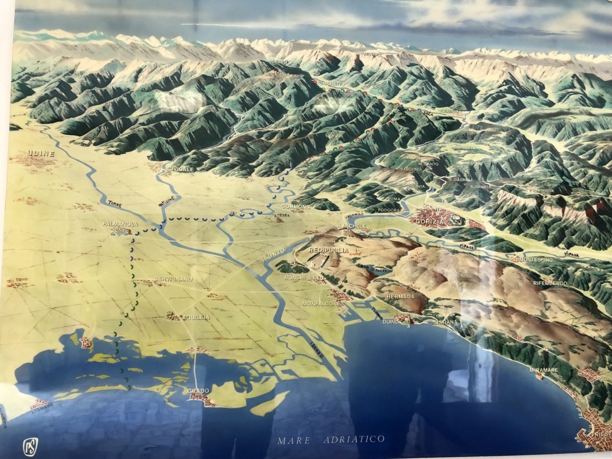
The Isonzo River cuts its way through a steep mountain valley in the Julian Alps to the north, exiting around Gorizia, then flowing between the Friuli plains to the west and the rugged limestone Carso plateau to the east, before entering the Adriatic Sea.
Monfalcone, wedged between the Carso (from which this picture was taken) and the Adriatic, is an important shipbuilding center, and prior to World War I was on the Austrian side of the border.

The shipyards at Monfalcone were established in 1908 by the Cosulich family (which owned a Trieste-based steamship line). It drew workers from all over the region, who ended up fighting on both sides when war broke out.

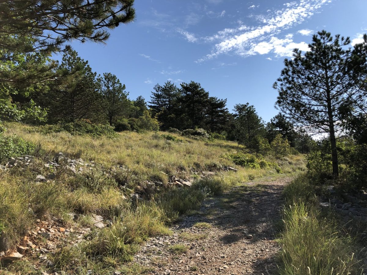
Italian trench lines from World War I on the limestone Carso ridge above Monfalcone.

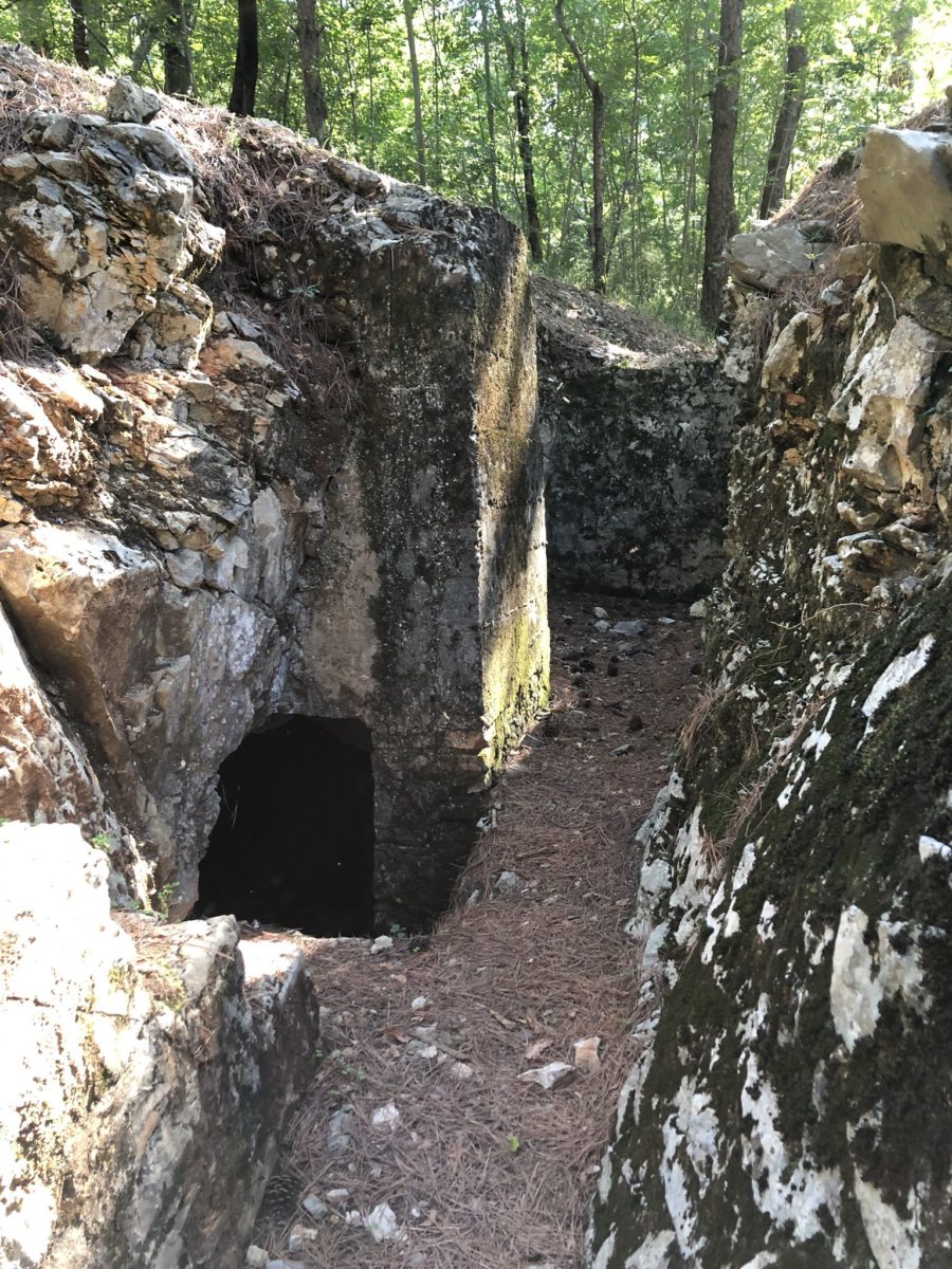


The trenches weren’t exactly easy to find, and required some uphill, cross-country trailblazing across the Carso, on the outskirts of Monfalcone, in my trusty rental car.
The shipyards in Monfalcone continued to operate through World War II up to today. Some of the largest cruise ships in the world are now built there.


Just up the road from Monfalcone is Redipuglia, where Mussolini built a massive war memorial into the side of the Carso, housing the bodies of over 100,000 Italian soldiers who were killed fighting over the nearby limestone ridges in World War I.

Heavy artillery from World War I, at the Italian war memorial on the Carso at Redipuglia.

Some displays from the World War I museum at Redipuglia, Italy. She even brought you socks.


Whether in China or Italy, I always trust liquor that’s named after a grenade, comes in a bottle shaped like an artillery shell, or both. At the WWI museum at Redipuglia, Italy.

World War I battlefield souvenirs for sale, at the war memorial at Redipuglia, Italy.

The lower Isonzo River at Gradisca, Italy. It floods in the spring and can run nearly dry in the summer.

The town of Gorizia, now in Italy on the border with Slovenia, was a major bone of contention during World War I. The Italians finally captured it from the Austrians after a year of fighting, in August 1916, but lost it a year later in the disaster at Caporetto.


The castle at Gorizia dates from around 1146, and the English astronomer Edmund Halley (of comet fame) helped design some of its later fortifications. It was severely damaged during World War I.


The view from Gorizia Castle, in Italy, across the border into Slovenia.

The Natisone river valley and the pass at Robic, through which German troops poured into the Friuli plains in late October 1917, after breaking through Italian lines at the Battle of Caporetto.


The town of Kobarid (aka Caporetto) in the mountains of northwest Slovenia, scene of Italy’s disastrous defeat in October 1917.

talian war memorial built by Mussolini to house the remains of over 7,000 Italian soldiers killed in the Battle of Caporetto, at Kobarid (Caporetto) now in northwest Slovenia.

Looking south from the Italian war memorial at Kobarid (Caporetto) at the upper Soca (Isonzo) River flowing down towards Gorizia.

or much of World War I, before the great Italian defeat at Caporetto, the fight between Italian and Austrian troops was waged along the very tops of these mountain ridge lines, above the Upper Soca (Isonzo) River in what is now northwest Slovenia.

Monument to local Slovenia partisans during World War II, at Zaga on the Upper Soca (Isonzo) River. When I stopped to take this photo, some of the local residents exclaimed “Tito!”

Fort Kluze, built by the Austrians (on the site of an earlier castle) during World War I to guard the entrance to the Alpine pass to Tarviso. North of Bovec in what is now Slovenia.


Access road and tunnel carved by Austrian soldiers in World War I to construct Forts Kluze and Hermann in the Alps north of Bovec, Slovenia.


Austrian trenches in front of Fort Kluze, in the Alps north of Bovec, Slovenia.


Austrian war cemetery from WWI, outside Bovec, in the mountains of northwest Slovenia. Almost all the gravestones are blank, the dead unknown.

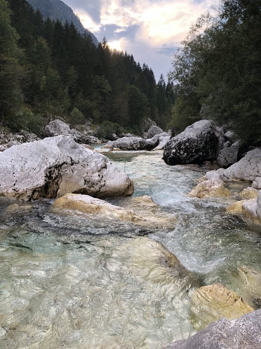
The Upper Soca (Isonzo) River, coming down from the Julian Alps in northwest Slovenia.

Footbridge across the Upper Soca (Isonzo) River in the Julian Alps, in northwest Slovenia.

The Soca River flowing down from the Julian Alps in northwest Slovenia.

Crystal clear waters of the Soca River in the Julian Alps, northwest Slovenia.
The high Julian Alps, approached from the south via the Soca River valley, northwest Slovenia.

Local Slovenian tending his vegetable patch high in the Julian Alps.

Memorial to local Slovenian partisans in the Julian Alps, during World War 2.

Winding my way up to the Vrsic Pass at 1,611 meters (5,285 feet) in Slovenia’s Julian Alps.


Nearing the top of the Vrsic Pass across Slovenia’s Julian Alps.

Rainstorm coming in over the Vrsic Pass across Slovenia’s Julian Alps.

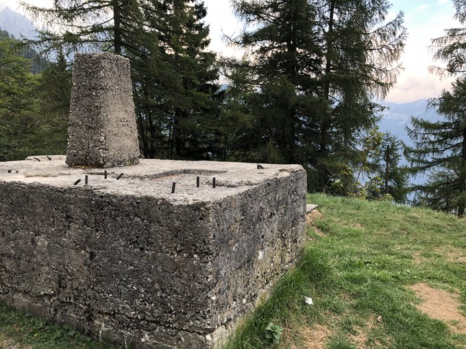
Concrete base of an Austrian army cable system for moving supplies across the Vrsic Pass during World War I.
Descending the Vrsic Pass across Slovenia’s Julian Alps via the “Russian Road”, constructed by Russian POWs during World War I, to help the Austrians supply their troops on the Italian Front.

Kranjska Gora, in the Sava Dolinka valley north of the Julian Alps, near Slovenia’s border with Austria.

A roadside reminder of the Cold War, crossing the once-heavily guarded border between Slovenia (formerly part of Yugoslavia) and Austria.

Slovenia’s Julian Alps, seen from my airplane home.

Leave a Reply