December 20, 2022
Over Scotts Bluff and Into Wyoming.
As we arrived in the outskirts of Scottsbluff, we came across the grave of Rebecca Winters. A Mormon emigrant, age 50, she died here in 1852 of cholera. Her husband Hiram chiseled her name into an iron wagon tire, which still stands over her final resting place.

Always good to see we’re on the right path.

Scott’s Bluff presents a barrier to any easy movement west along the North Platte. Though there is a visible gap in the middle, that path was rugged and not feasible when the first emigrants arrived.

That means the first emigrants had to travel around it to the south, and up Robidoux Pass, where we encountered some thick morning fog.

I mentioned the fur trader Joseph Robidoux before, back at his home in St. Joseph, Missouri. It was here in this valley that he built a trading post for Oregon Trail migrants going around Scottsbluff. The prices were rather steep.

Supposedly there’s a replica of his trading post here somewhere, but Google maps says it’s closed, and in any case it looks like it must be located on private land.

Once they reached the plateau above Robidoux’s trading post, the migrants could continue west. But we returned down to visit Scott’s Bluff itself.

On our way back, we spotted some turkey vultures (also known as turkey buzzards). Someone on Twitter suggested that meant something dead must be nearby.

We also came across this farm with what at first glance looked like deer grazing nearby.(We saw a couple of deer earlier, in Robidoux Pass).

Those aren’t deer, though. Those are llamas.

Bales of hay in the morning fog, south of Scott’s Bluff, Nebraska.

The local Native Americans called Scott’s Bluff Me-a-pa-te, “the hill that is hard to go around”.

You might wonder who Scott was and why it’s his bluff. Well, Hiram Scott was a fur trapper who was injured and left for dead here in 1828. Unlike Leonardo di Caprio, he did not make it out and seek his revenge. They found his body later, where it was left.

In 1851, a road was constructed through the gap in Scotts Bluff, called “Devil’s Gap” due to the howling winds that tore through it.

The gap soon replaced Robidoux Pass as the main route on the Oregon Trail, as well as the route for the later Pony Express.

The road later became known as Mitchell Pass when the army built Fort Mitchell on the other side of the gap in 1864.

Just before passing into Wyoming, we encountered this nondescript site, where a huge Indian encampment called “The Great Smoke” took place in 1851, when the tribes were called to Fort Laramie to negotiate safe passage for the Oregon Trail migrants. Obviously that didn’t work out.

Crossing into Wyoming.

Just inside Wyoming, outside of Lingle, is the site of another clash with Indians. In 1854, a Mormon migrant’s cow either wandered off or was stolen. US Army Lt. Grattan was sent out to retrieve it. Tempers flared, shots were fired, and Grattan and his 29 men were all killed.

A short distance down the road is Fort Laramie, where Lt. Grattan was based. It was originally established as a private fur trading post in 1834, where the Laramie River meets the North Platte.

Taken over by the US army in 1849 – the year of the California Gold Rush – Fort Laramie quickly became a major base on the western frontier for both negotiations with and campaigns against the Plains Indians tribes.


Fort Laramie offered Oregon Trail migrants a chance to restock on supplies or rest and recover for the journey ahead.
This reenactor at Fort Laramie is portraying one of the many Mormon migrants who, unable to afford wagons, pulled their own handcarts all the way to Utah. More on that later.

A view inside the officers family quarters at Fort Laramie, which remained an operating army post until 1890.


An iron bridge was built across the North Platte River at Fort Laramie in 1876 – the same year as Custer’s defeat at Little Big Horn – to ensure troops could be sent in any direction to respond to an emergency.

Following the path of the original Oregon Trail north out of Fort Laramie, Wyoming.

It’s taking us to the grave of Mary Homsley, a 28-year-old migrant for Oregon. In 1852, after giving birth, she and the baby caught measles. They were thrown from the wagon trying to cross the North Platte to get to Fort Laramie, and both died soon after.

Looking back at Fort Laramie from the Oregon Trail.

Stopping for snacks in the nearby town of Fort Laramie, Wyoming.

Remember kids: You mess with the bull, you get the horns. Fort Laramie, Wyoming.

Passing a freight train loaded with coal, on the way to Guernsey, Wyoming.

Speaking of freight trains loaded with coal, in Guernsey, Wyoming

Migrants on the Oregon Trail carved their names into Register Cliff here outside Guernsey, Wyoming.


The Trail is still following the North Platte River to the northwest.

And the Pony Express is still following the Oregon Trail.

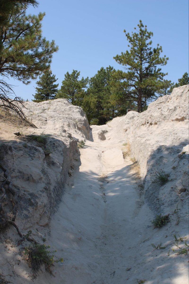
The rugged stone cliffs south of present-day Guernsey presented yet another challenge to the migrants on the Oregon Trail.

The original wagon ruts here are carved deep into the rock. Imagine riding over that all day with no shock absorbers.

Below, next to the river, lies the grave of 24-year-old Lucindy Rollins from Dayton, Ohio. She died in 1849, the year of the Gold Rush, but where she was headed and how she died is unknown.

From Guernsey, the migrants struck out of a long northwestern route running parallel, but not next to, the North Platte River, across the lonely prairies of eastern Wyoming.

To alleviate the tedium, we’ve taken a brief detour to the town of Douglas, Wyoming, home of the jackalope, a mythical mix of jackrabbit and antelope. It’s kind of the Wyoming version of Big Foot.

Another impressive steam locomotive, courtesy of Douglas, Wyoming.
Just north of Douglas, we stopped by the somewhat scant remains of Fort Fetterman, established in 1867 as a forward-positioned base in the wars against the Plains Indians.

Officer quarters at Fort Fetterman, Wyoming.

Fort Fetterman was extremely exposed to the wind and snow, and was considered a hardship post.

Native American eagle feather headdress, on display at Fort Fetterman, Wyoming.

A short drive and a world away from Fort Fetterman is Ayres Natural Bridge, a popular rest stop and natural wonder along the Oregon Trail.

The rock arch is located in a secluded canyon, on a creek running towards the North Platte. It was so much cooler here than on the surrounding plains, it felt very refreshing.

The landscape just outside Ayres Natural Bridge, south of the North Platte River in southeast Wyoming.

The Oregon Trail rejoined the North Platte here at the Deer Creek Crossing, in present-day Glenrock, Wyoming. Camp grounds like these, offering fresh water and firewood, would become rarer in the days ahead.

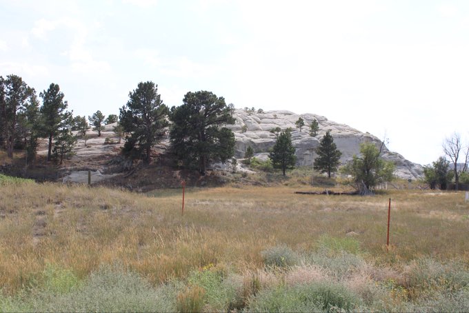
Glenrock takes its name from “the rock in the glen”, a large outcropping that served as a landmark for fur trappers and later for migrants along the Oregon Trail.
On a dirt road west of Glenrock lies the grave of Ada Magill, a 3-year-old little girl who died of dysentery on the trail in 1864. She was the youngest of six children. Her parents and siblings made it to Oregon. They buried her in her best Sunday calico dress.
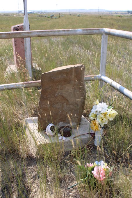
Next to Ada’s grave, a marker put down in more recent times: 1913.

Arriving in Casper, Wyoming, the biggest city we’ve seen since leaving Missouri. Home to a significant oil industry.

Casper is home to a small but very nice museum, the National Historic Trails Interpretive Center, that features an audio visual presentation on life on the western trails.


From there we went to a campground on the North Platte, near where the emigrants forded, for our own taste of life on the trail.

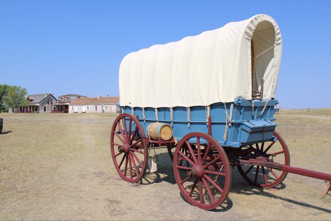
Here comes the wagon now.

This wagon is a bit larger than most the emigrants would have had, more like small freight wagon. But the people who own it once took it across the entire Oregon Trail, in what must have been an epic journey.

At least some of the trails out here are THE Trail, leading to Emigrant Gap, which we’ll see in a bit, when we’re back on the road.

But for the moment, we got an appreciation for just how bumpy every single mile of the Oregon Trail must have been in a wagon.
That’s why most people would have walked beside their wagon the entire 3,000+ miles, not ridden in them. The wagons were mainly for carrying supplies, not people.
This wagon is being pulled by horses. Though faster, horses didn’t have the strength of oxen, or the endurance of mules, either of which were preferred for the Oregon Trail.
A vista along the Oregon Trail, just outside of Casper, Wyoming.

The children on the Oregon Trail would have spent the day scampering about collecting these: dried cow (or in their case bison) chips for use as fuel, in lieu of available firewood.

Back to camp along the North Platte River. I had to watch my feet for rattlesnakes while I wandered off to take this photo.

An Indian tepee set up at camp. You could stay in them for the night. We chose the hotel, because we knew we had a tough ride the next day.

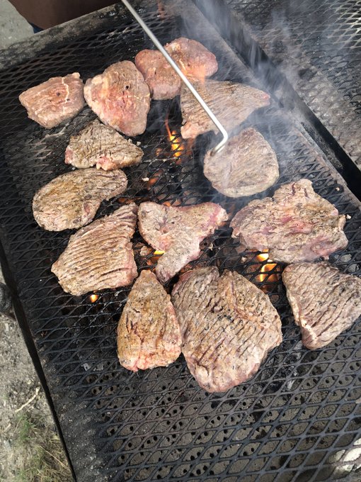
Cooking up steaks for dinner. Outside Casper, Wyoming.

Migrants on the Oregon Trail only would have had fresh meat when they hunted – which they sometimes were able to do. Otherwise they would have had bacon, jerky, and other preserved foods.
One staple along the Oregon Trail was soda biscuits, prepared, like these are, in a Dutch oven.

You have to love it when a meal comes together.

In another Dutch oven, berry cobbler for dessert.

The horses taken a well-deserved rest. Just outside Casper, Wyoming.

Sharing tales at camp after dinner. The woman on the far right traveled the entire Oregon Trail in the wagon we just rode.

Wild flowers just outside of camp, near Casper, Wyoming.

Wild flowers outside of Casper, Wyoming.

Sunset on the Oregon Trail, outside of Casper, Wyoming.

The journey continues here in Part 6: Crossing the Continental Divide.
[…] The journey continues here in Part 5: Over Scotts Bluff and Into Wyoming. […]